Back to: ZOOLOGY 500 Level
Welcome to class!
Hello, my brilliant scholar! It’s always a pleasure to see you here, curious and ready to grow. Today, we’re diving into one of the coolest tools modern ecologists use to see the world from above—satellite imagery. Yes, we’re talking about those stunning images taken from space that help scientists study the Earth without even stepping outside. Let’s unpack what satellite imagery is all about and how it can help you as a future zoologist and environmental expert.
Basics Of Satellite Imagery
What is Satellite Imagery?
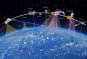
Satellite imagery refers to pictures or data of the Earth’s surface that are captured by satellites orbiting high above our planet. These satellites take detailed snapshots using sensors, allowing us to observe land, water, vegetation, clouds, and even human structures—all from space.
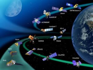
In simple terms, satellite imagery helps us “see” the earth from the sky. It’s like standing above Nigeria and looking down at forests in Cross River, lakes in Borno, or the city lights of Lagos—all in real time or historical view.
Why Satellite Imagery Matters in Ecology
Monitoring land use and vegetation changes over time (e.g., forest loss in Edo State)
Tracking natural disasters like flooding, wildfires, and droughts
Identifying and mapping habitats and ecosystems
Observing animal migration patterns by viewing large landscapes
Studying climate change effects on different regions
As a zoologist, satellite imagery helps you understand how landscapes affect animals and how human activities impact biodiversity. You don’t have to be on the field all the time—you can study patterns from your screen!
Types of Satellite Imagery
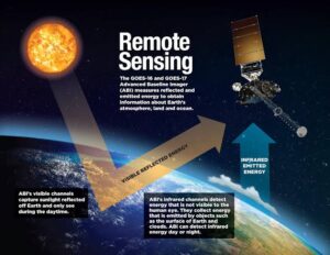
Optical imagery: Uses visible light to capture what we would see with our eyes. Great for mapping vegetation and land use.
Infrared imagery: Captures heat and is useful for detecting water stress in plants or heat signatures of animals.
Radar imagery: Penetrates clouds and darkness. Useful in tropical regions like Nigeria where cloudy skies are common.
Real-Life Example from Nigeria
In the Niger Delta, satellite imagery has been used to track oil spills, monitor mangrove destruction, and check illegal logging. Conservationists and government agencies use this data to take action without needing to be physically present in every area.
Tools and Resources You Can Use
Google Earth: Free and easy to use for beginners
Sentinel Hub: Provides high-quality imagery from ESA satellites
Landsat: Long-term data for environmental monitoring
NASA Worldview: Offers near-real-time satellite imagery
Things to Keep in Mind
Satellite images can sometimes be cloud-covered, especially during the rainy season.
Interpretation requires training—understanding colours, shadows, and patterns takes practice.
Images may need processing and analysis software like QGIS, ENVI, or ArcGIS to be fully useful.
Summary
- Satellite imagery involves viewing Earth from space to gather environmental data
- It’s used in habitat mapping, disaster tracking, and conservation planning
- Types include optical, infrared, and radar imagery
- It’s a key tool for zoologists studying large-scale patterns in nature
- Tools like Google Earth and Sentinel Hub make imagery accessible to everyone
Evaluation
- What is satellite imagery, and why is it useful in ecological studies?
- Name two types of satellite imagery and their specific uses.
- How can satellite images help in conservation efforts in Nigeria?
- Mention two tools you can use to access satellite imagery for free.
You’re learning how to see the world like never before—from the sky! With knowledge like this, you’re on your way to becoming a 21st-century ecologist—equipped, empowered, and ready to make impact. Keep growing, keep shining, and remember—Afrilearn is cheering you on every step of the way!